In addition to the components that are configurable and utilisable via Geoconcept Web, as described in the previous pargraphs, Geoconcept Web enables publishing of Geoconcept maps, while respecting the standards of the Open Geospatial Consortium (OGC). In this way, two types of Web Services enable publishing a Geoconcept map:
- Web Map Service (WMS): this is an OGC web service standard that enables maps to be produced dynamically from georeferenced data; the server is called each time there is a query from a client workstation. The Geoconcept map can then be shared on a server and is visible via client workstations reading WMS format, as is the Geoconcept GIS.
- Web Map Tiles Service (WMTS): this is a standard describing the way to publish cartographic data in the form of predefined tiles. The WMTS is a complement to the WMS. As compared to the WMS, the main advantage of the WMTS is that it offers better performances in the publishing of cartographic data, as the tiles are stored in a cache at the time of the first generation. On the other hand, the WMTS is not recommended when the data are updated frequently, since it then means the cache has to be invalidated for the data to be brought up to date.
The Administration module for the web application offers a functionality for publishing view tabs in Geoconcept maps in WMS or WMTS format, while respecting OGC standards.
It is therefore necessary to have deployed the web application, following the steps described in the Geoconcept Web installation guide.
This functionality features an interface for creating layers to be published in WMS or WMTS format.
![[Warning]](images/community/docbook/warning.png) |
Warning |
|---|---|
|
Don’t forget to activate WMS or WMTS services (refer to the section in the Geoconcept Web Installation Guide / Settings / Activating Geoconcept Web WMS and WMTS. |
The procedure for publishing a view tab in WMS or WMTS format is as follows:
- In the Administration tab and then the / option, select :
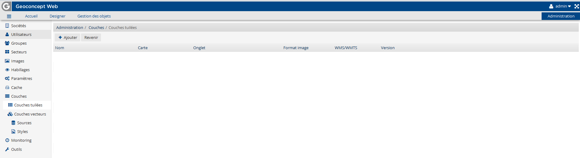
-
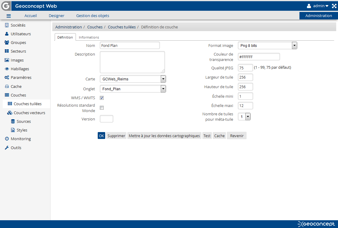
In the text entry interface, fill in values for the following fields:
- Name : type in the name that will be visible to users when they consult the WMS or WMTS service from a third party application (for example, the Geoconcept GIS),
- the 'WMS/WMTS' check-box should be checked,
- Map: choose the map to publish from those shown in the drop-down menu,
- Tab : select the map view tab to publish,
-
Select the image format required:
- PNG format is recommeded as an image format because it allows a better resolution for images generated,
- The format called PNG with transparency allows transformation of «the colour white» on a Geoconcept map so it is transparent in the image generated. This format is useful for displaying layers that are superimposed in relation to one another.
|
Warning |
|---|---|
|
To be on the safe side, do not put any special characters or any spaces in the layer name, the map name or the view tab name. |
- Once these parameters have been assigned values, click on .
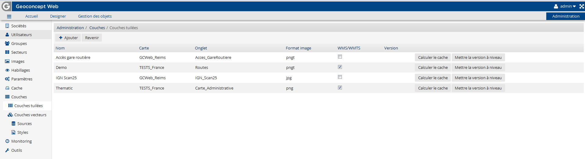
A layer configured in the portal is accessible in WMS or WMTS format with the same configuration. The format requested depends on the client : if they want WMS, they specify this in the query with the term WMS. The procedure is the same for WMTS.
![[Tip]](images/community/docbook/tip.png) |
Tip |
|---|---|
|
Each published layer is available in three projection systems:
|
WMS - Web Map Service
GetCapabilities:
http://<server>/geoconcept-web/wms?request=GetCapabilities
http://<server>/geoconcept-web/wms?request=GetCapabilities
The view tab for your Geoconcept map is published in WMS format. It is accessible via a third party display tool that is capable of reading WMS format via the following query :
Example of a WMS image request query: http://gcweb.geoconcept.com/gws/wms?request=GetMap&VERSION=1.3.0&CRS=epsg:27572&BBOX=551533.765952,2313284.041120,566370.515430,2321072.501656&LAYERS=France&FORMAT=image%2fpng&WIDTH=800&HEIGHT=600
WMTS - Web Map Tile Service
KVP and REST protocols are supported for WMTS by the application. WMTS 1.0.0 OGC is also supported (http://www.opengeospatial.org/standards/wmts).
GetCapabilities:
Example: http://gcweb.geoconcept.com/gws/wmts?request=GetCapabilities&version=1.0.0&service=WMTS
- REST encoding : http://<server>/<webapp>/wmts/1.0.0/WmtsCapabilities.xml
Example: http://gcweb.geoconcept.com/gws/wmts/1.0.0/WmtsCapabilities.xml
http://<server>/<webapp>/gws/wmts?request=GetCapabilities
GetTile:
- REST encoding : la ResourceURL d’un layer est décrite dans le getCapabilities : http://<server>/<webapp>/wmts/<layerIdentifier>/<styleIdentifier>/<TileMatrixSet>/<TileMatrix>/<TileRow>/<TileCol>.png
Example: http://gcweb.geoconcept.com/gws/wmts/France/Server2/epsg:27572/0/0/0.png
- The view tab for your Geoconcept map is published in WMTS format. It is accessible via a third party display tool that is capable of reading WMTS format via the following query:
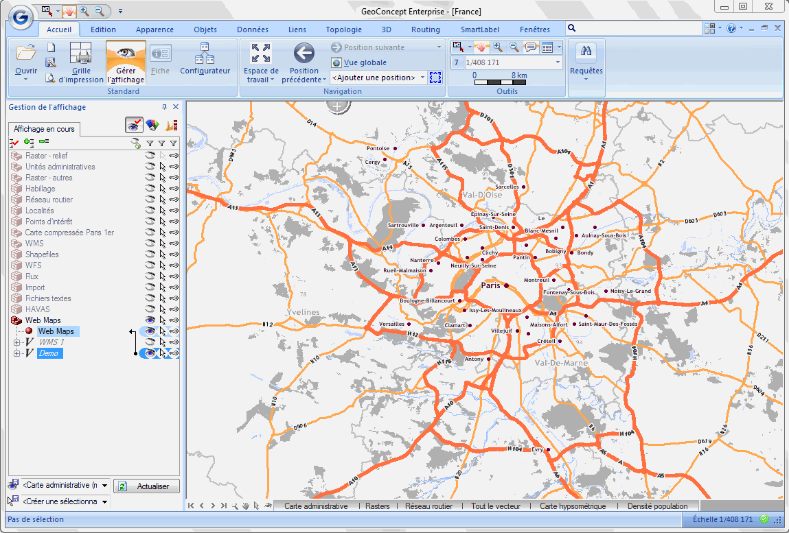
Example of a WMS result
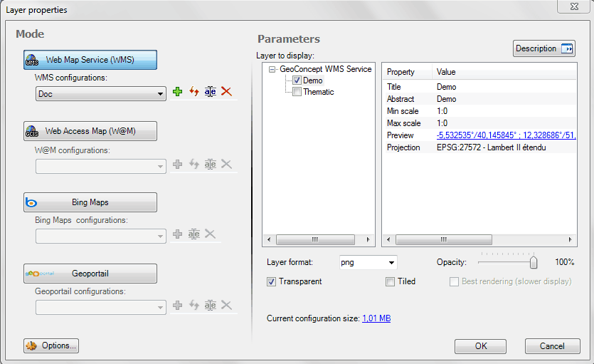
The following example was configured for displaying in the Standalone Geoconcept GIS solution (client for reading WMS layers) layers configured in the WMS server described earlier.
The Demo and Thematic view tabs have been configured as WMS or WMTS layers.
When the WMS server is called from Geoconcept, the dialogue box will allow the display of those layers that have been configured :
The Demo layer is displayed via Geoconcept Webmaps.